Learn which of your favorite spots along the Blue Ridge Parkway in North Carolina are still accessible.
Last updated on April 2nd, 2025
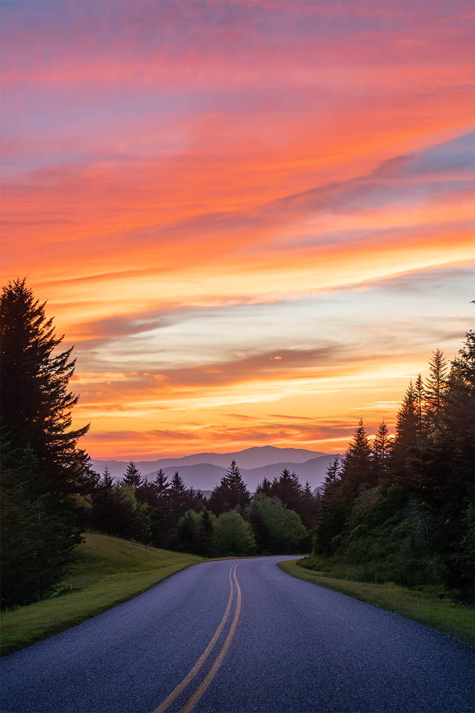
Hurricane Helene really did a number on Western North Carolina. More than six months after the storm, there are still sections of the Blue Ridge Parkway that are under repair and closed to the public. The official Blue Ridge Parkway closures page can be hard to navigate, so we put together this helpful guide to plan your visit to the Parkway in 2025.
The good news is there are many awesome spots that are currently accessible!!
We’ll divide up this post by sections of the Parkway. We’ll update this post and our interactive map as new sections are opened until the entirety of the Blue Ridge Parkway is opened once again.
Scroll to the bottom of the post for an interactive map and link to load map in Gaia GPS.
**This guide does not include weather-related closures. Weather-related closures become extremely infrequent after April 1st but you should still check the official page linked above for updated weather closures.**
Southern End –
Cherokee, Maggie Valley, Waynesville
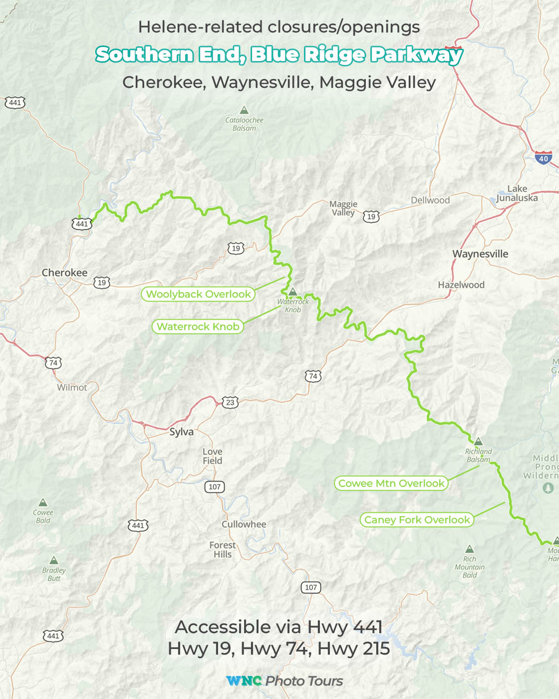
Green = Open
Red = Closed
This is the section that stretches from Cherokee to Hwy 215. Thankfully this section is fully open and includes some of the following photographer favorites:
- Wollyback Overlook
- Waterrock Knob
- Cowee Mountain Overlook
- Caney Fork Overlook
This section of Parkway is accessible via Hwy 441 near Cherokee, Hwy 19 near Maggie Valley, Hwy 74/23 Near Waynesville, and Hwy 215 between Rosman and Canton.
Pisgah Forest –
Asheville, Canton, Brevard
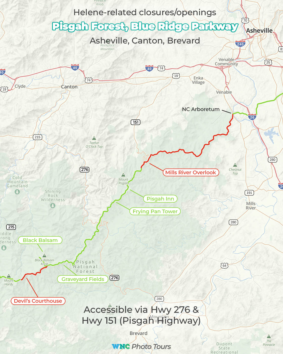
Another section with a lot of fan-favorites that are currently accessible. The open section includes the following locations:
- Black Balsam
- Graveyard Fields
- Skinny Dip Falls
- Frying Pan Tower
- Pisgah Inn
- Mt. Pisgah
This open section of Parkway can be accessed via Hwy 276 from the Canton area or from Brevard. It can also be accessed via Hwy 151 (Pisgah Highway) up from the Candler area.
The stretch between Hwy 151 and the NC Arboretum is closed. You can get on the Parkway near the Arboretum going north around the outskirts of Asheville.
Mt. Mitchell –
Asheville, Little Switzerland, Spruce Pine
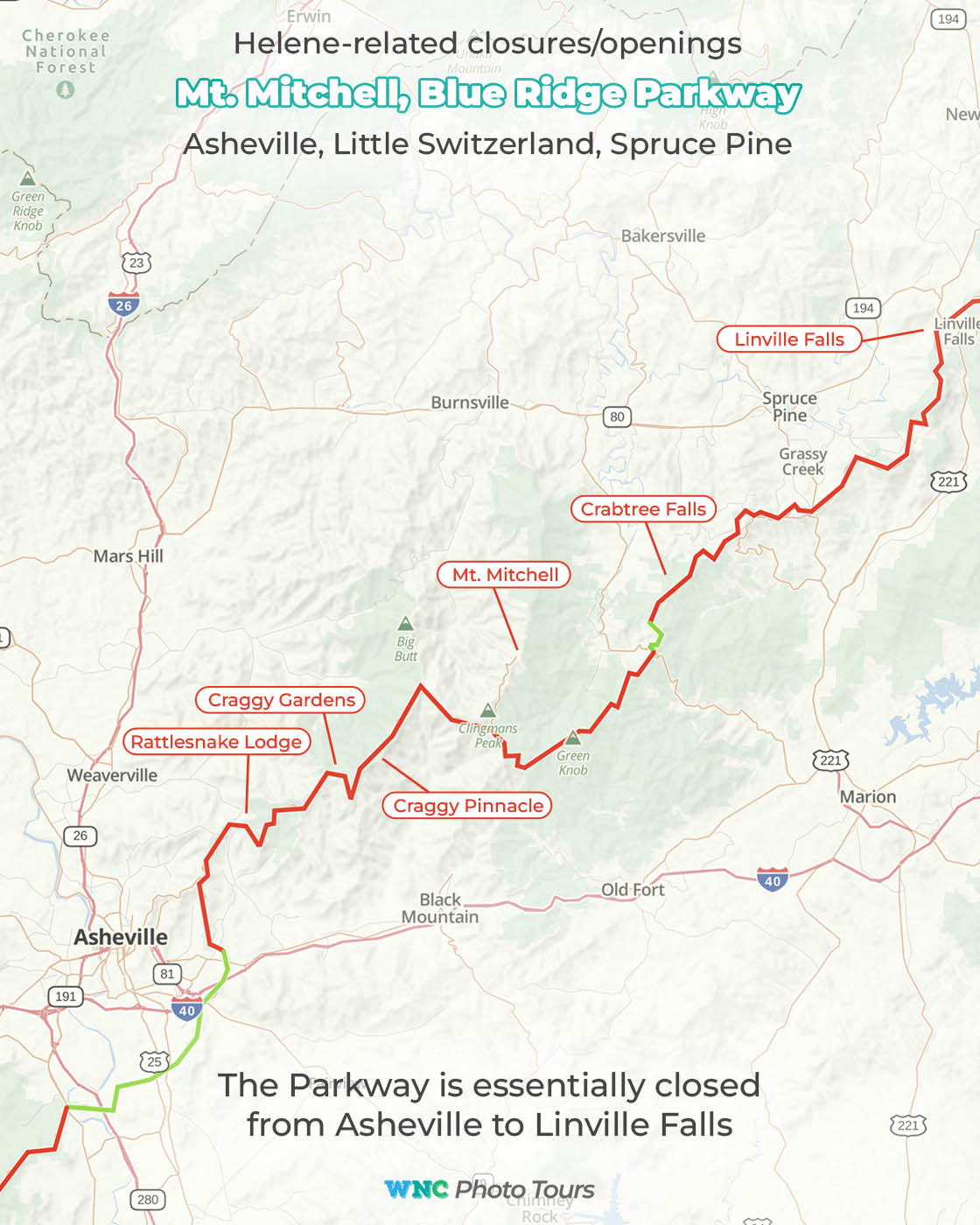
Unfortunately, the Mt. Mitchell section of the parkway going north from Asheville is completely closed. This area was the hardest hit by the storm and we are not holding our breath waiting for it to reopen. This section includes some of the popular spots:
- Rattlesnake Lodge
- Craggy Gardens
- Craggy Pinnacle
- Mt. Mitchell State Park
- Crabtree Falls
- Linville Falls
Northern End –
Linville, Blowing Rock, Boone
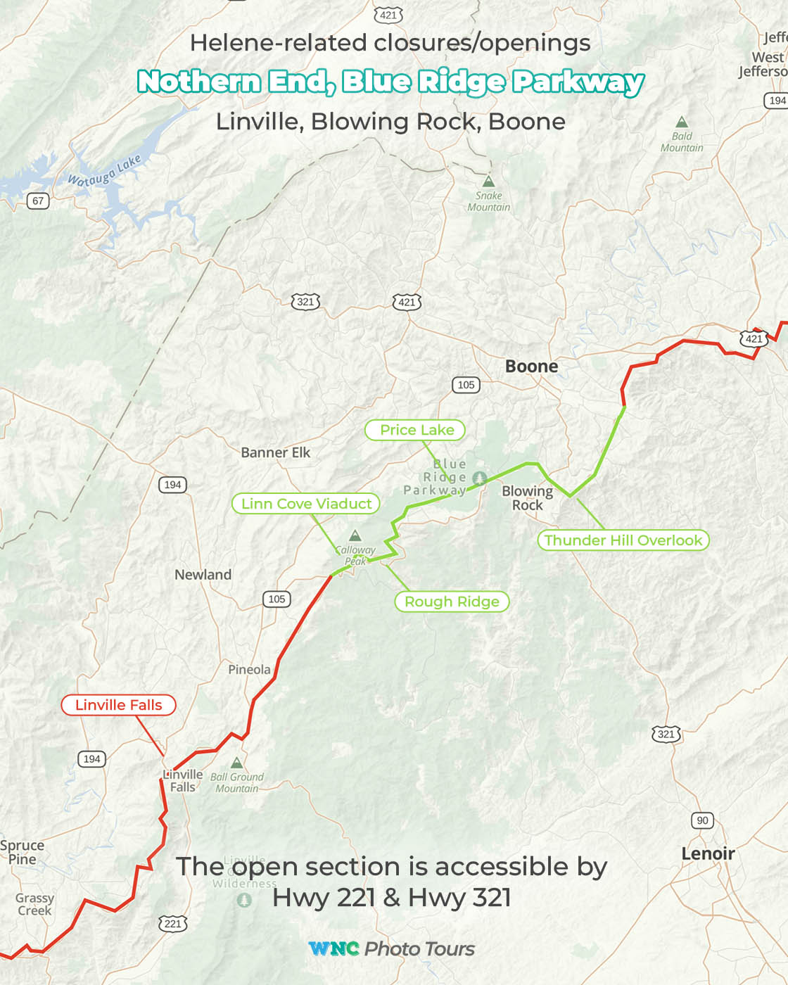
This is a mixed bag, with some good spots that are unaccessible such as Linville Falls and Duggers Creek Falls, but some great spots that are currently accessible include:
- Linn Cove Viaduct
- Rough Ridge
- Price Lake
- Thunder Hill Overlook
The open section highlighted in green can be accessed via several posts along Hwy 221 and Hwy 321.
Northern End –
Boone to VA state line
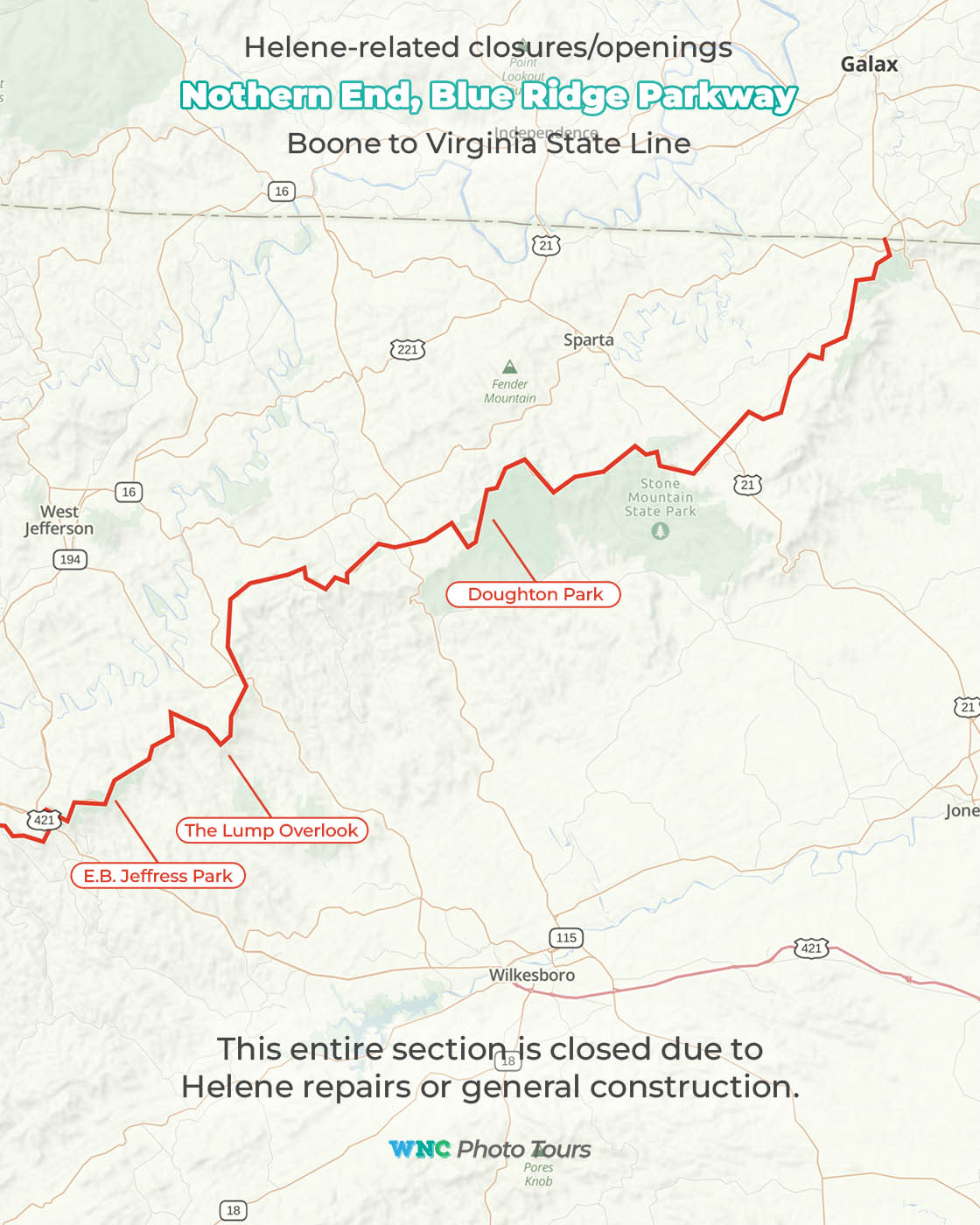
Unfortunately for the time being, everything north of Boone on the Parkway is closed for Helene repairs or general construction.
We expect more sections throughout the Parkway to open as 2025 progresses, and we will add updates here.

